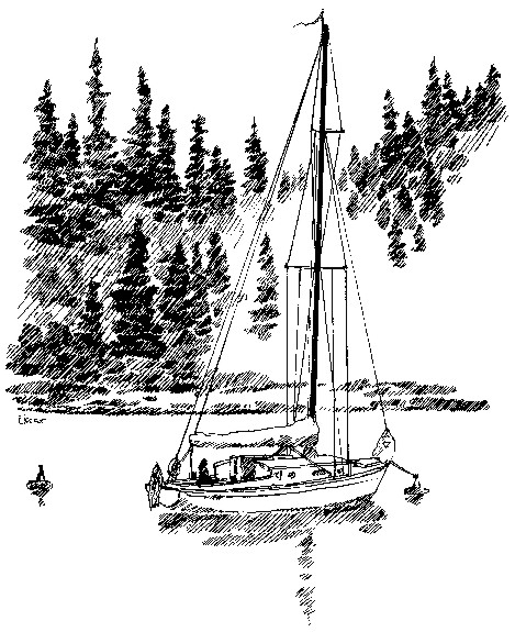
Larry Eifert – Originally published in the Seattle Times, September 2005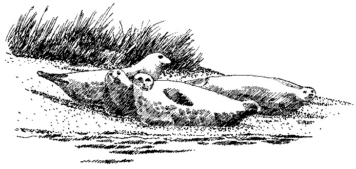 Mystery Bay. Sounds like a romantic getaway destination at a far-flung tropical resort, but it’s right here only thirty miles from Seattle. Tell boaters you’re heading for that nearly landlocked bay near Port Townsend, and most will say, “Not me, I’m not putting MY boat on the mud. You can’t get in there!” On the other hand, taking the road less traveled has always been the preferred path of an artist, and so our 1939 boat, Sea Witch, closed on the entrance buoy to Kilisut Harbor. Behind us, Port Townsend’s classic waterfront lay only two miles to the northwest. We were going to Mystery Bay.Sea Witch, this old sailboat of ours, is like an old friend. Built in 1939, it has its share of quirks, but, like any old sole, it’s also experienced and trustworthy – and we knew her capabilities. We’ve kept it a vintage boat, adding only a small measure of modern systems we thought might help our sailing and cruising. No pressurized cold water, just a beautiful brass hand pump. No hot water, just a big teapot that lives on the cabin wood store. No radar or computerized charts – instead, we have a depth sounder and a chart book dated 1978 (and written by Peyton Whitely, a Seattle Times staff writer almost 30 years ago. And, we take it easy, carefully working out our voyage to fit the tides and currents using Washburn’s Tables. Today, it was an incoming tide, so if we strayed onto a mud flat it wouldn’t be for long. Approaching this channel you pass the military ordnance depot at Indian Island, which helps to make this area parklike. No trophy houses here, just fir and cedar forests lining an unused beach – and a few signs warning that entry here probably means a new mailing address at Gitmo Bay. Keeping in the center of the channel, at buoy number 5 we came up to Rat Island, a local name for the guardian sand spit sometimes connected to Marrowstone Island at low tide.The channel hooked here, the top of a giant question mark (how appropriate), and as we came around the corner we were greeted with a cacophony of noise. Suddenly we were into a whirling mass of cormorants and gulls, all centered over an area ahead that seemed filled with drift logs piled up on the beach. The sounder registered 18 feet here, but as we always say, you can’t get in trouble when it still reads double-digits. Then, motoring closer we realized the logs were actually harbor seals, dozens of them, hauled out for an afternoon snooze and looking exactly like piles of drift logs. A few still in the water came over to check us out and it felt like we were in some remote or Alaskan harbor far to the north.
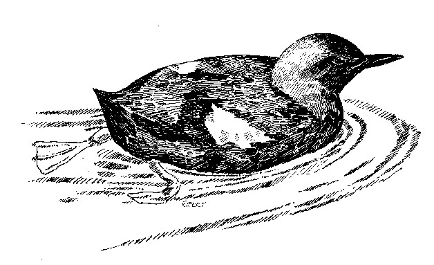
Ahead of us on the outside of this giant turn, Fort Flagler State Park appeared. It has a summer dock, launching ramp with a campground and mooring buoys right off the channel. According to our chart, it was imperative that we stay in the channel here, and obvious that if we strayed outside the question mark we’d cooked. The sounder was reading 20 feet but I could understand immediately that this was what most careless navigators did, cut the corner and prolong your journey by doing a little bottom cleaning. Ahead, Fort Flagler looked tempting. Just pick up a mooring buoy for the night and our snakelike navigating would be finished. But continuing on, we rounded the next corner and followed more channel markers. At number 17 we saw the sounder come up to 12 feet, but it was never less than that. It’s also interesting to note that, according to our chart, there are supposed to be 22 markers but are actually only 12. Our old chart didn’t match very many of them either, but it didn’t matter much. Stay in the middle of the channel and we did just fine. Finally we were past the last markers and into Kilisut Harbor, that long and skinny bay between Marrowstone and Indian Islands. Ahead lay our destination, tiny and secluded Mystery Bay. All over this smooth bay were groups of pigeon guillemots, black and white pigeon-like birds, diving for fish. Their bright red-orange feet made it clear what they were, and occasionally one would open its mouth to show us matching red in there too. Small rafts of rhinoceros auklets were here too, their bills sporting small hornlike appendages and head feathers swept back like Elvis impersonators. An eagle passed overhead going in our direction and seemed to be showing us the way.
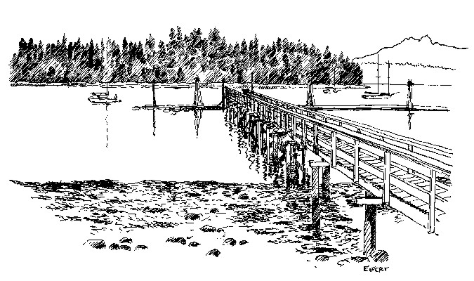
Mystery Bay is said to have been so named because of smugglers on the island during Prohibition days. Transporting booze from Canada was a highly profitable and somewhat honored occupation in the remote waters of northwest Washington, and hidden between Marrowstone and Indian Islands, Kilisut Harbor must have been a great retreat to evade Coast Guard vessels. Smugglers’ boats could have been easily hidden in the overhanging trees at the small bay near the end of the harbor, and it’s said that smugglers’ regular disappearances here were categorized by the Coast Guard as “mysterious,” hence the name of the bay.As we rounded the corner we could see Mystery Bay State Park ahead. Surely one of the smallest state parks in Washington, it has a dock and mooring buoys. On shore we could see latrines, a water spigot and picnic shelter, but no camping. Picking up a buoy, we were home for the night in one of the most sheltered and quiet anchorages we’ve seen in the entire Northwest.
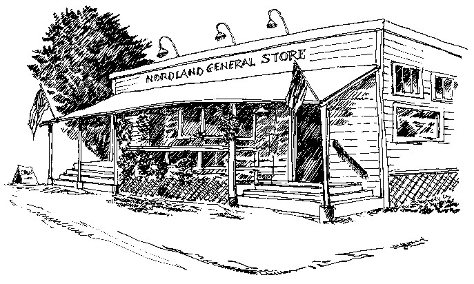
Down at the bay’s shallow end we could saw Marrowstone Island’s only year-round store, the old Nordland General Store. This is the center of activity for this island community; a focus for social networking over coffee around the old stove, where the only concession to a change is to serve expresso. And while many rural communities have lost their sense of neighborhood to WalMart or Hollywood Video, the Nordland store is alive and well, providing what groceries and entertainment is needed here. We decided that Nordland General Store may be the best part of Mystery Bay – or maybe it was the water warm enough for swimming!
We spent the evening here, enjoying the sunset across Kilasut Harbor as we cooked dinner. I did some sketches of the harbor and our experience coming in, and thought there could be no better illustration of what’s wonderful about this place we call home. ***previous*** — ***next*** |